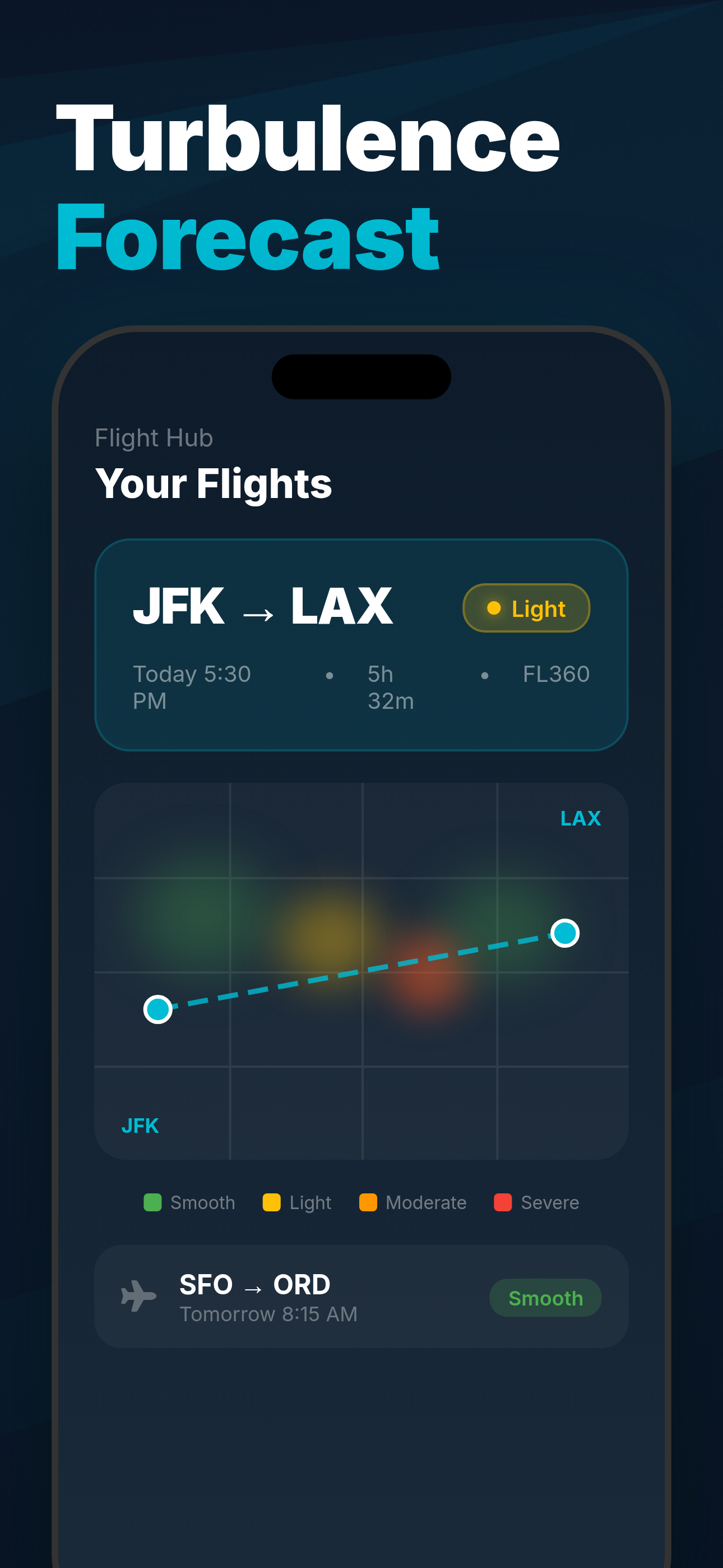
MEX to CDG Turbulence Forecast
Is the Mexico City to Paris flight turbulent? Live forecast & historical patterns.
Mexico City · Paris · 12h 15m
⚠️ Heavy turbulence today
Get exact timing, altitude & best seat — free
★★★★★ 4.8 · 20,000+ reviews · iOS & Android

Scan to get the full forecast
★★★★★ 4.8 · 20,000+ reviews · iOS & Android · Free
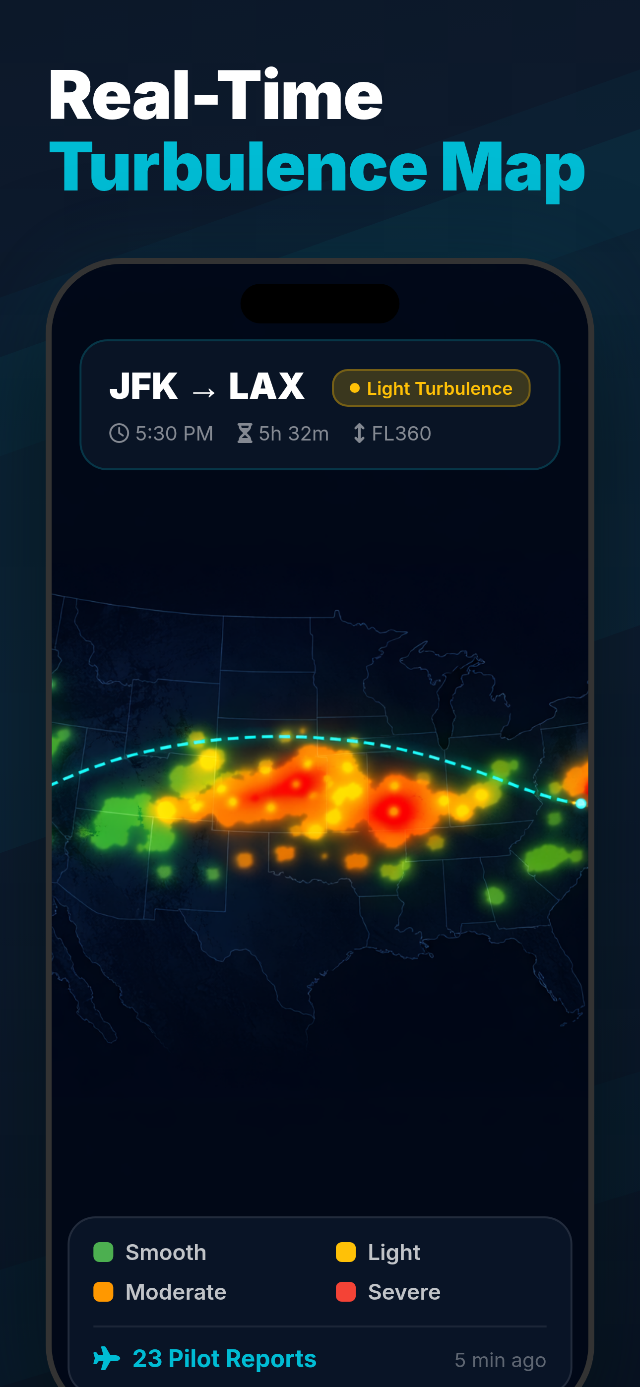
Typical turbulence along the route
Historical average pattern for MEX–CDG
0h1h2h3h4h5h6h12h 15m
About the MEX–CDG route
The Mexico City to Paris route crosses the North Atlantic, where the jet stream is the primary source of turbulence. Flying at 39,000 feet, the aircraft encounters the strongest bumps roughly 2–5 hours into the flight. This is clear-air turbulence — no clouds, no visual warning — which makes a pre-flight forecast especially valuable.
The route is served by Air France, Aeromexico on Airbus A350 · Boeing 777 aircraft,
with flights typically cruising at 39,000 feet over a distance of 6,329 miles (5,500 nautical miles).
💡 Tip: Turbulence peaks mid-flight over the Atlantic. First and last hour are usually smooth.
Mexico City to Paris Flight Time
How long is the flight from MEX to CDG?
39,000 ft
Cruising Altitude
The Mexico City (MEX) to Paris (CDG) flight takes approximately 12h 15m,
covering 6,329 miles (5,500 nautical miles) at 39,000 feet.
The route is operated by Air France, Aeromexico.
Return flights (CDG to MEX) take a similar time, though westbound transatlantic and transpacific routes are typically 30–60 minutes longer due to headwinds.
Turbulence levels on MEX–CDG
What to expect at each phase of the flight
SmoothDeparture & arrival — climb and descent phases are generally calm
LightMinor bumps — drink stays in your cup, walking feels slightly unsteady
ModerateNoticeable bumps — stay seated with seatbelt on, service may pause
HeavyStrong jolts — unsecured items move, crew seated. Rare but possible
Get minute-by-minute timing for your specific flight
Best time to fly MEX–CDG
Turbulence by month
Best seat on MEX–CDG
Airbus A350
✓ Wing
Rows 22–38
Smoothest
Wing seats are over the center of gravity — least affected by turbulence.
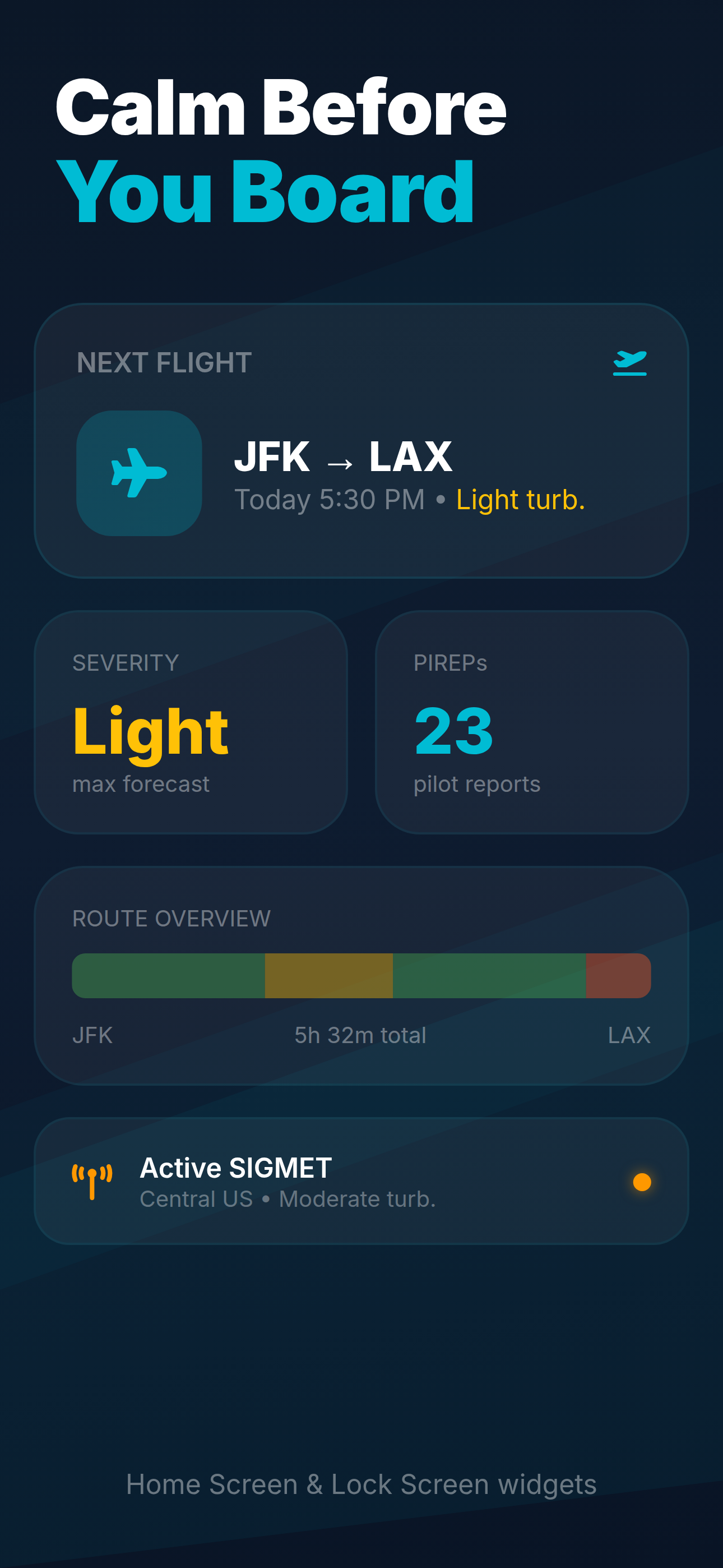
What you'll see in the app
Full forecast, live map & seat recommendations
Related guides
Learn more about flight turbulence
Passenger Reports
Fly Mexico City–Paris a few times a year. June is the worst month for this route — somewhere over Greenland it was severe turbulence, no question. Seatbelt sign on from about an hour in until descent. Experienced crews handle it well.
Frequent flyer · June
Genuinely the most turbulent flight I've taken in years. Crossing mid-Atlantic was intense — dropped suddenly a few times, overhead bins opened, one person in the back was sick. Crew strapped in for a solid hour.
Experienced traveler · June
I had no idea this route was known for turbulence. Things got terrifying over the North Atlantic — massive drops, the whole plane groaning. Nobody was hurt but I've never seen flight attendants look that focused. Would have been nice to know in advance.
First-time passenger · April
Frequently asked questions
Is the Mexico City to Paris flight turbulent?
The MEX–CDG route typically experiences heavy turbulence. Moderate turbulence expected — fasten seatbelt when seated. The turbulence score for this route is 62/100.
When is turbulence worst on MEX to CDG?
Turbulence peaks mid-flight over the Atlantic. First and last hour are usually smooth. Check the turbulence chart above for the typical pattern along this specific route.
Which seat is smoothest on MEX to CDG?
Wing seats are always the smoothest. On a Airbus A350 (the most common aircraft on this route), that's rows 22–38. Avoid the very rear of the aircraft — it amplifies turbulence motion.
How long is the flight from MEX to CDG?
The MEX to CDG flight takes approximately 12h 15m, covering 6,329 miles (5,500 nautical miles).
Which airlines fly MEX to CDG?
The main airlines operating this route are Air France, Aeromexico, flying Airbus A350 · Boeing 777 aircraft.
Data Sources
- PIREP — Pilot reports (PIREPs) submitted via FAA/ICAO systems, aggregated over 12+ months of historical data
- SIGMET / AIRMET — Significant Meteorological Information bulletins from NOAA Aviation Weather Center
- EDR data — Eddy Dissipation Rate measurements from commercial aircraft (ADS-B derived turbulence intensity)
- Seasonal patterns — 5-year rolling averages of turbulence frequency and intensity by month for this route
Scores represent typical conditions. Actual turbulence varies daily. For real-time forecasts, use the Turbulence Forecast app. · About our data